


Voting District UNITY TWP SW, Columbiana County, Ohio
About
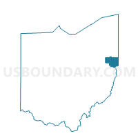
Outline

Summary
| Unique Area Identifier | 643773 |
| Name | Voting District UNITY TWP SW |
| County | Columbiana County |
| State | Ohio |
| Area (square miles) | 9.98 |
| Land Area (square miles) | 9.95 |
| Water Area (square miles) | 0.03 |
| % of Land Area | 99.69 |
| % of Water Area | 0.31 |
| Latitude of the Internal Point | 40.85206590 |
| Longtitude of the Internal Point | -80.60345740 |
Maps


Graphs
Select a template below for downloading or customizing gragh for Voting District UNITY TWP SW, Columbiana County, Ohio


Neighbors
Neighoring Voting District (by Name) Neighboring Voting District on the Map
- Voting District COLUMBIANA VIL C, Columbiana County, OH
- Voting District ELKRUN TWP SIGNAL, Columbiana County, OH
- Voting District FAIRFIELD TWP CENTER, Columbiana County, OH
- Voting District FAIRFIELD TWP NORTH, Columbiana County, OH
- Voting District FAIRFIELD TWP SE, Columbiana County, OH
- Voting District MIDDLETON TWP NORTHEAST, Columbiana County, OH
- Voting District MIDDLETON TWP NORTHWEST, Columbiana County, OH
- Voting District UNITY TWP NEW WATERFORD, Columbiana County, OH
- Voting District UNITY TWP NORTH, Columbiana County, OH
- Voting District UNITY TWP SE, Columbiana County, OH
Top 10 Neighboring County Subdivision (by Population) Neighboring County Subdivision on the Map
- Unity township, Columbiana County, OH (9,957)
- Fairfield township, Columbiana County, OH (9,890)
- Elkrun township, Columbiana County, OH (4,687)
- Middleton township, Columbiana County, OH (3,612)
Top 10 Neighboring Place (by Population) Neighboring Place on the Map
Top 10 Neighboring Unified School District (by Population) Neighboring Unified School District on the Map
- Beaver Local School District, OH (15,957)
- East Palestine City School District, OH (8,285)
- Columbiana Exempted Village School District, OH (7,862)
- Crestview Local School District, OH (5,898)
Top 10 Neighboring State Legislative District Lower Chamber (by Population) Neighboring State Legislative District Lower Chamber on the Map
Top 10 Neighboring State Legislative District Upper Chamber (by Population) Neighboring State Legislative District Upper Chamber on the Map
Top 10 Neighboring 111th Congressional District (by Population) Neighboring 111th Congressional District on the Map
Top 10 Neighboring Census Tract (by Population) Neighboring Census Tract on the Map
- Census Tract 9514, Columbiana County, OH (7,652)
- Census Tract 9501, Columbiana County, OH (5,712)
- Census Tract 9515, Columbiana County, OH (4,654)
- Census Tract 9504, Columbiana County, OH (4,443)